Upcoming UD GIS Coffee Hour Meeting
Presentation: New ArcGIS apps: ArcGIS Pro and Insights for ArcGIS, Geri Miller, Esri (Philadelphia, PA)
Date: Tue October 10, 2017 | Time: 10:00 to 11:30 am
Location: Pearson Hall, Faculty Commons
Welcome to GIS at UD!
UD community members have been working with GIS for over 25 years. Today, GIS is used in some way in most colleges and departments on campus. Support for GIS at UD is sponsored by units in the Library and Information Technologies.
News & Events
August 18: Coffee Hour!
On Tuesday, August 18, from 10am-11:30am, UD GIS will host a coffee hour via Zoom.
The Zoom link will become active on the day of the meeting.
MEETING AGENDA
– GIS presentation by Feng Qi (see details below)
– GIS software for 2020-2021
– GIS workshop Fall 2020
– GIS Day 2020
– Roundtable discussion
PRESENTATION
Title: Geospatial analysis for infectious disease research: a case study on influenza and reflections on COVID-19
Description: The presenter will first share with the audience her past research on spatiotemporal analysis of human space-time activities for a micro-scale influenza transmission study. The study used AGPS devices to collect data on student trajectories during the flu season on an urban university campus. Spatiotemporal processing and visualization methods were developed to derive spatiotemporal patterns. The study revealed transmission hotspots on the university campus and provided recommendations for control and prevention strategies during the flu season.
Directly related to this influenza study and relevant to the current COVID-19 crisis is the topic of contact tracing. The presenter will discuss issues on this regards and also survey the various ways the geospatial community are making contributions to COVID-19 research, including building real-time dashboards and interactive maps for public awareness, characterizing human mobility patterns and trends, detecting COVID-19 hotspots, simulating and modeling the spread and impacts of COVID-19, measuring spatial accessibility to healthcare resources, and identifying vulnerable populations and high-risk settings.


April 21: Coffee Hour!
On Thursday, April 21, from 10am-11:30am, UD GIS will host a coffee hour via Zoom.
MEETING AGENDA
– GIS presentation by Dr. Tracy DeLiberty UD (details below)
– GIS software: support on work from home
– GIS software: support on teach from home
– Earth Day virtual Mapathon 4/22
– Roundtable discussion
PRESENTATION
Title: Investigating the changing landscape of Delaware using remotely sensed data and spatial analytical tools
Description: Tracy DeLiberty is an associate professor in the Department of Geography and Spatial Sciences. Her research expertise lies in the broad areas of climatology, GIS, and remote sensing. Tracy’s interests focus on investigating land cover and land use change caused by climate, ecological, and socioeconomic drivers.

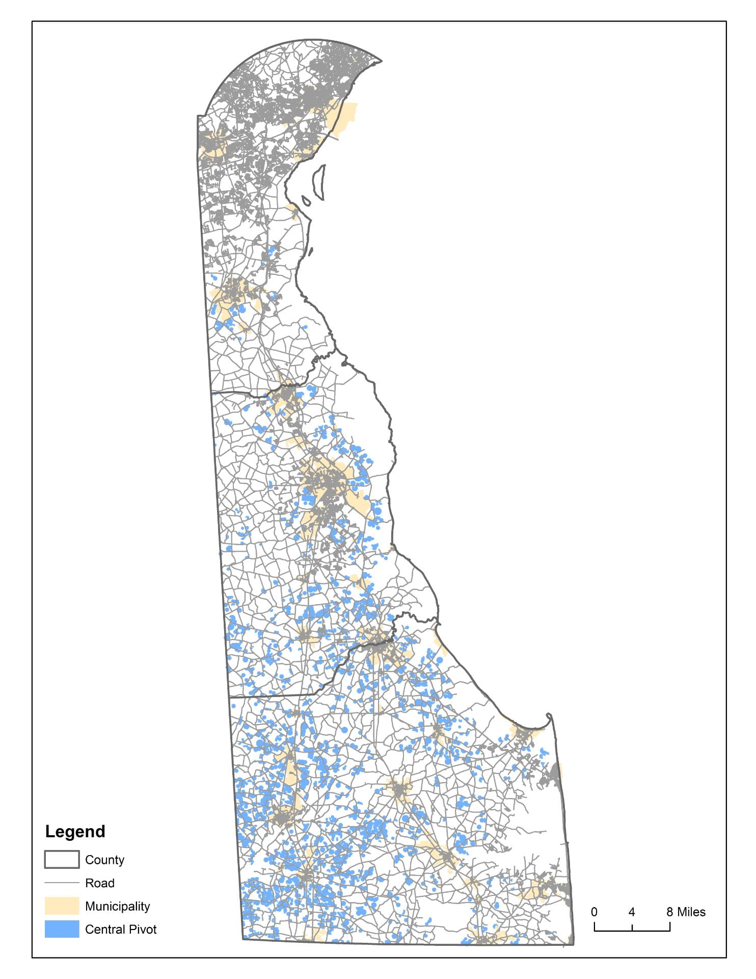
Her earlier work revolved around natural land cover changes and its impact on climate, but over the last 5-10 years the focus has shifted to human-induced landcover change contributing significantly to anthropogenic releases of CO2 to atmosphere, changes in hydrologic dynamics, and alterations in habitat for almost all terrestrial species. Improved information on and understanding the landcover/landuse dynamics to environmental changes is her passion. Tracy will share with you several current research projects focused on Delaware that include estimating crop water demand using Landsat imagery, investigating cover crop practices, and looking at the impervious surface cover change in the beach communities. She will also outline the courses she teaches, and describe the Graduate GIS Certificate and the new GIScience & Data Analytics 4+1 programs.