2020 Agenda
|
09:00 AM – 09:10 AM |
Miriam Pomilio, State of Delaware Tracy DeLiberty, University of Delaware Jing Gao, University of Delaware |
||
| 09:10 AM – 09:20 AM | Traveling the Path to Digital Wildlife Area Maps | Deborah Sullivan, Sr. Application Support Specialist, Department of Technology and Information (DTI) | For many years the Department of Natural Resources and Environmental Control (DNREC) Division of Fish and Wildlife produced paper maps of each wildlife area with deer stands, duck blinds and other points of interest. Fast Forward to 2020, Time to go Digital! This presentation will outline the transformation from paper maps to ArcGIS Online interactive maps and the hub that holds them all together. |
| 09:20 AM – 09:30 AM | Mapping Poverty in Delaware |
Becky McColl, Assistant Policy Scientist, Center for Community Research and Service, University of Delaware Erin Lynch, Assistant Policy Scientist, Center for Community Research and Service, University of Delaware |
This presentation uses a series of maps to explore poverty levels among Delaware residents. More than one in ten Delaware residents live in poverty, and nearly one in five children in the state are below the poverty level (2014-2018 American Community Survey). Studying poverty level by location can be an important tool in examining the different needs of Delaware residents living in urban, suburban, and rural areas of the state, and analysis of trends can inform resource utilization and policy decisions. |
| 09:30 AM – 09:40 AM | Invasive Species Mapping in Estuarine Wetlands using High-Resolution Aerial Imagery | Matthew Walter, Graduate Student, Department of Geography and Spatial Sciences, University of Delaware | Phragmites australis is a widespread invasive plant species in the United States that greatly impacts wetlands by creating dense patches and outcompeting other plants. The invasion of the plant into wetland ecosystems is known to decrease biodiversity, destroy the habitat of threatened and endangered bird species, and alter biogeochemistry. While the impact of phragmites is well-known, the extent to which the plant affects wetlands is not known across the United States. In this presentation, I will use high-resolution imagery from the National Agricultural Imagery Program (NAIP) to map phragmites for the entire state of Delaware. Remote sensing techniques such as normalized difference vegetation index (NDVI) and principal component analysis (PCA) are used to achieve a high overall accuracy for the phragmites classification. The classified map has a spatial resolution of 1m and documents the spatial distribution of phragmites throughout the state. Such detailed classification could aid in monitoring the spread of this invasive species over time and inform the decision-making process for landscape managers. |
| 09:40 AM – 09:50 AM | Experiencing the Experience Builder |
Jay W. Hodny, City of Newark, DE, Public Works and Water Resources Department Co-Authors: Brian Laws and Mark Neimeister, City of Newark, DE, Public Works and Water Resources Department |
The City of Newark, DE continues to build, configure and implement several Esri-based ArcGIS solutions for internal staff and management use and to serve information to the community. Rather than manage and maintain many discrete GIS applications, we are exploring the use of Experience Builder as a way to combine multiple Workforce, Survey123 and Dashboard apps into a “one-stop shop” for asset repair, maintenance, and management. The presentation will highlight experiencing the Experience Builder. |
| 09:50 AM – 10:00 AM | Networking Break | ||
| 10:00 AM – 10:30 AM | Career Panel |
David Black, Cecil County, Maryland Sarmistha Chatterjee, Esri Lillian Wang, Delaware Geological Survey John Watson, EBA Engineering, Inc. john.watson@ebaengineering.com |
|
| 10:30 AM – 10:40 AM | K-12 GIS Education | Christina Marsett, High School Social Studies Teacher, William Penn High School | GIS software is gaining traction as a powerful tool for geospatial analysis in K-12 classrooms across both the country and the State of Delaware. Colonial School District has played a key role in this as it was the first in the state to provide all students in grades 6-12 with ArcGIS accounts. This session will provide an overview of how GIS is being used to reinforce geography standards in high school social studies courses. |
| 10:40 AM – 10:50 AM | Educating Students Using Geospatial Technologies | Mary Schorse, Program Director, Delaware Center for Geographic Education | Geospatial technologies provide a powerful tool for visualizing instructional content and providing unique opportunities for interactive learning. They also represent a skillset in high demand across all sectors of the economy. Learn how DCGE is helping teachers bring these tools to their students to expand college and career readiness. |
| 10:50 AM – 11:00 AM | Networking Break | ||
| 11:00 AM – 11:30 AM | Where’s Waldo?: Using ArcGIS and Deep Learning Tools for Object Detection in Imagery and Videos | Eric Wagner, Esri | Aerial imagery forms the foundation for many datasets, analyses, and maps today. Tracing or observing conditions of features from basemaps is a common workflow that takes even the best analysts many hours to complete manually. With the proliferation of imagery at higher spatial and temporal resolutions, automatically detecting objects is more critical to the expediency of these workflows than ever before. This presentation will look at how imagery from aircraft, drones, and satellites can be processed within ArcGIS Pro using available deep learning geoprocessing tools to automatically detect and identify features. The best part? No coding required! |
| 11:30 AM – 11:40 AM | Closing Remarks |
Olena Smith, University of Delaware John Huffman, University of Delaware |
|
| 11:40 AM – 12:00 PM | Networking Break | ||
| 04:00 PM – 07:00 PM | Mapathon |
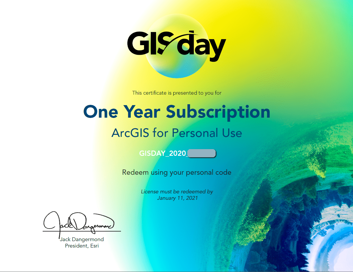
This year’s prizes
- 5 individual ArcGIS for Personal Use licenses – a $100 value (product link).
- EBA Engineering swag bag – flash drive, reusable bag, water bottle, Band-Aids, and a thermal can holder
- Delmarva GIS – beach towel, notebook, pen, and a reusable bag
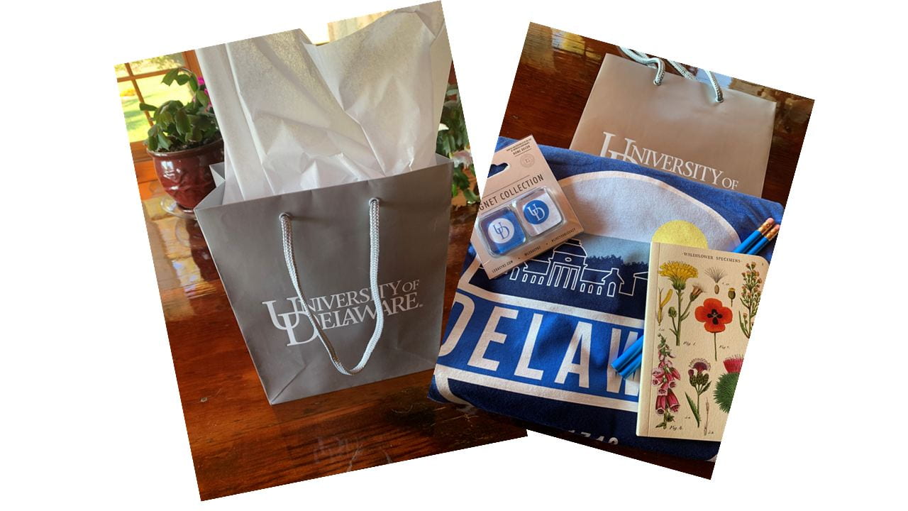
- 2 goodie bags from the Department of Geography and Spatial Sciences, UD – t-shirt, a small notepad, pencil, and magnet