
We reached the bright orange subsoil (a non-cultural soil layer) in the north half of the trench (Test Unit 4), but no wall. The excavation of the south half of the trench unearthed a range of artifacts, including a slate pencil and nineteenth-century ceramics. We finished the excavation of the Test Unit 3 and began the slow process of mapping and photographing the unit. In Test Unit 5, we excavated several layers of soil with several interesting artifacts like a stoneware marble and a lice comb fragment before finding a demolition layer of stone and mortar. To the southwest of the dwelling, we also found another wall feature which likely corresponds to the “corn house” depicted on the 1843 Barney map.
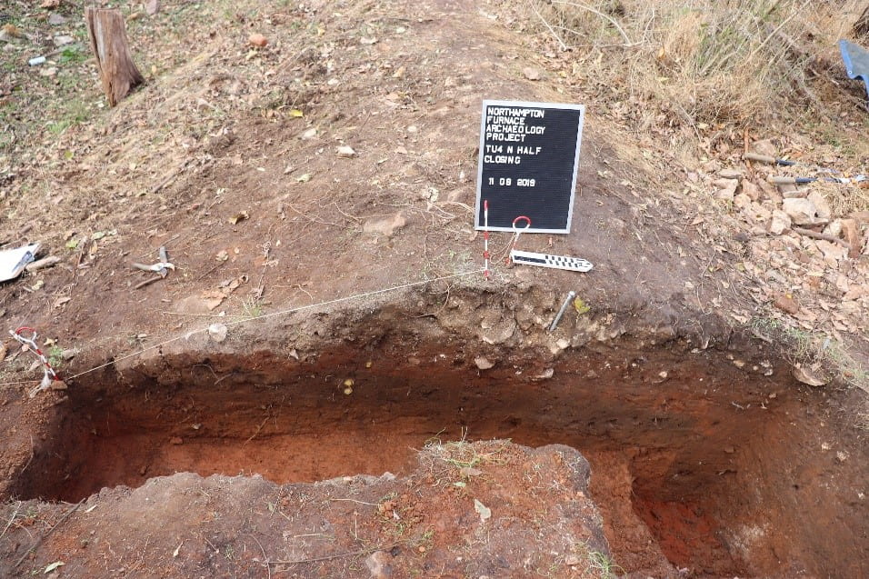
West wall profile of the north half of TU 4 (left side) and TU 2 (right side). The mortar and rock layer is visible just below the sign board as is the bright orange subsoil.
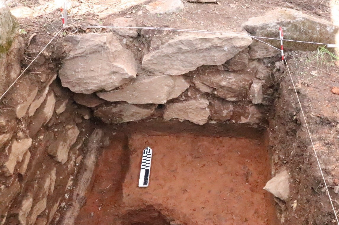
TU 3 showing the north and west foundation walls

A slate pencil found in the south half of the trench, TU 4
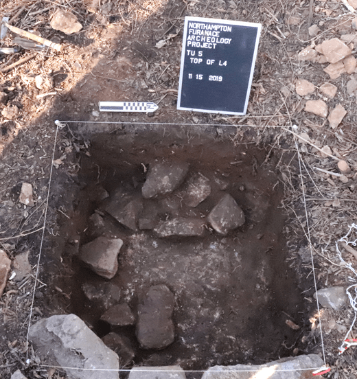
Demolition layer in TU 5