
PROJECTS
Lorem ipsum dolor sit amet, consectetur adipiscing elit, sed do eiusmod tempor incididunt ut labore et dolore magna aliqua. Ut enim ad minim veniam, quis nostrud exercitation ullamco laboris nisi ut aliquip ex ea commodo consequat. Duis aute irure dolor in reprehenderit in voluptate velit esse cillum dolore eu fugiat nulla pariatur. Excepteur sint occaecat cupidatat non proident, sunt in culpa qui officia deserunt mollit anim id est laborum
Your Title Goes Here
Your content goes here. Edit or remove this text inline or in the module Content settings. You can also style every aspect of this content in the module Design settings and even apply custom CSS to this text in the module Advanced settings.
Understanding geography standards
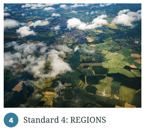
Created by DCGE, the storymaps below highlight key concepts embedded within each of the four geography standards. They have been well received by teachers and were utilized in a series of professional learning workshops during Spring 2022.
 |
 |
 |
 |
Geospatial technology in the classroom
GeoInquiries™ are short, standards-based inquiry activities for teaching map-based content found in commonly used textbooks. Collections of 15-20 activities per topic enhance your curriculum throughout the year.
An Intro to Teaching with Maps
Geoinquiries and the Delaware Geography Standards
DCGE hosts periodic teacher training workshops on using geonquiries. Join our mailing list to stay informed about upcoming events.
https://drive.google.com/file/d/1T_3IzlAKp7TgZ8K3kAHBU4aVqq1MHGrN/view?usp=sharing
https://drive.google.com/file/d/1W6sZAk6Ttj-AFN77fq5MJN9Sh_XLsbBr/view?usp=sharing
https://drive.google.com/file/d/1W3qEf8p6xEO7K9kvcGT1NusWV3ZKj1O7/view?usp=sharing
2021 Earth Observation Day Webinar
Earth Observation Day (EOD) is a Science, Technology, Engineering, and Mathematics (STEM) education and outreach event to celebrate the Landsat mission, a joint effort of the U.S. Geological Survey (USGS) and the National Aeronautics and Space Administration (NASA).
Every day, Landsat satellite imagery provides information to scientists, researchers, farmers, forest managers, policy makers, and many others that helps them make wise decisions about our resources and our environment.
EOD is organized by AmericaView, a nationwide, university-based, and state-implemented network that advances Earth observation education.
DCGE partnered with DelawareView to celebrate the launch of Landsat 9 and share resources teachers can use in their classroom.
https://docs.google.com/presentation/d/1cPYOTHvIgWznCi4XXl2STfPjvRMEXq4BvcaFmgW2Jo8/edit#slide=id.p
Earth Observation Day (EOD) Poster Game (and Water/Landsat Storymap)
To celebrate Earth Observation Day and the Launch of Landsat 9, DCGE partnered with DelawareView to take the 2021 EOD Day poster/game to teachers and students. Middle and high school students in the Christina School District learned about the challenging decisions required to balance economic development and natural resource conservation.
Teachers interested in scheduling a visit or receiving a copy of any of the EOD Poster Games
Delaware Teachers Institute
Info pending
GIS Day Activities
https://drive.google.com/drive/u/1/folders/1poGtFSw-KZcbxH6doIyhD6jGdm4rKijk
https://geoeducation-in-delaware-delaware.hub.arcgis.com/pages/gis-day
DE/ESRI Storymap Competition
PDMS Course #26122: Using Geographic Information Systems (GIS) in the classroom
Digital DE streamlines access to a variety of digital and online resources to better support educators with instruction in all learning environments. This course will introduce Geographic Information Systems (GIS) and and walk participants through how to use GIS in instruction using pre-made lessons and digital maps. The online software that is referenced and utilized is ArcGIS Online (www.arcgis.com).
High school geography
The Delaware Center for Geographic Education worked with DelawareView to introduce students to remote sensing data and GIS tools for geographic problem solving by enhancing the 9th grade Geography in the Modern World core curriculum where students engage in topics such as population and migration, urbanization, industrialization and economic development, and global environmental change. With the use of ArcGIS Online, we are enhancing lessons to go beyond simply expanding the use of imagery and geospatial analysis tools and activities.
The curriculum was developed in 2017 by a state-wide teacher cohort to provide instructional resources in geography that allowed students the opportunity to gain proficiency in the Delaware Geography standards while simultaneously engaging in real world problem solving, engaging current (as opposed to historical) contexts. Since 2017, the five standards-based units of the course were updated to expand the use of remotely sensed imagery, ArcGIS Online and digital mapping with newer data layers, instructional materials, and new activities. Students learn how to track and make data collected using GPS, analyze change over time through image analysis, and dig deeper into spatial analysis using GIS technology. Student interns helped to update standards’ background materials and insert interactive maps using a story map platform.
Midldle school geography
Your content goes here. Edit or remove this text inline or in the module Content settings. You can also style every aspect of this content in the module Design settings and even apply custom CSS to this text in the module Advanced settings.